
Looking Up Grand Junction Neighbors
A block lookup has three layers: physical parcels, public record context, and community geography. Start with the exact address and the city or county label. Mesa Assessor supplies a parcel or account, while GIS tests the surrounding polygons and jurisdiction. The City Clerk may hold an addressed permit or license. A neighborhood layer can show an area, but it does not identify every person nearby.
The main block sources answer different questions:
| Source | What it shows about a block | Access |
|---|---|---|
| Mesa GIS viewer | Parcel polygons, parcel and account search, nearby layers | Public viewer; adjacent click or buffer mechanics not fully verified |
| Mesa District Lookup | Jurisdiction, precinct, school district, zoning, services, environmental overlays | Public parcel lookup; map context only |
| City GIS public-safety layer | Neighborhood, HOA, and neighborhood-watch polygons | Public service metadata; no member directory |
| Mesa voter report | Selected registered-list or history fields by precinct or district | Request, fee, filters, and confidentiality rules |
| City WebDrawer | Addressed permits, licenses, ordinances, and supporting documents | Custom search; indexed records only |
| Directories and newspapers | Historic occupants, offices, notices, and street continuity | Library, licensed database, or microfilm |
The table keeps “nearby parcel,” “registered voter,” “historic occupant,” and “association polygon” from becoming one broad claim about Grand Junction neighbors.
Mesa GIS for Grand Junction Blocks
Use the current Mesa GIS viewer after the assessor returns a parcel or account. The viewer searches by address, parcel, account, subdivision, intersection, place, or latitude and longitude. Query with Attributes can isolate a layer, the layer list is nested, and search results open in a second tab. District Lookup adds municipality, jurisdiction, Persigo, zoning, future land use, political districts, school districts, service providers, floodplain, soil, wildfire, airport, and mineral or geologic context.
The parcel-point ArcGIS service exposes OBJECTID, ACCOUNTNO, PARCELNUM, PARCEL_NUM, ASSOCPAR, and LOCATION, with a maximum record count of 2,000. Use those fields to record the parcels around the starting address. The city GIS map adds property, zoning, parks, public safety, transportation, utilities, and ZIP-area layers. County and city maps can overlap while still using different jurisdiction labels.
Open the Mesa parcel-point service before viewing the capture below; it shows a structured parcel route.
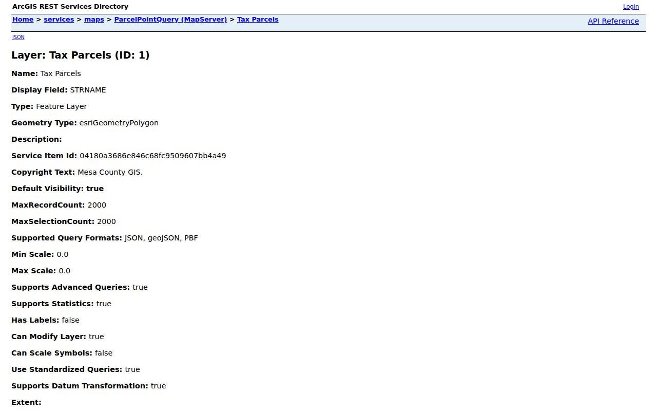
A map point is a lead to the assessor and legal description, not a final boundary ruling.
Note: The county describes GIS as reference and planning context, so preserve the map date, layer name, account, and source system.
Adjacent Parcels Around Grand Junction
Adjacent-parcel research should move from a map pin to a record. The exact click or buffer behavior of the current viewer was not fully text-exposed, so the safe process is explicit. Identify the target parcel, enable parcel and parcel-point layers, inspect the surrounding polygons, write down each account or parcel number, and open each one in the assessor report.
- Save the starting address, parcel, account, location, mailing, and report date.
- Zoom to the parcel and record the neighboring polygons without relying on color or proximity alone.
- Run each adjacent account through the assessor and compare location, mailing, use, neighborhood, and prior or associated parcel fields.
- Use the legal description, plat, or recorded instrument to test whether a shared line, driveway, or road frontage is actually relevant.
- Keep the source date and mark any boundary as map context until the recorded or official parcel source confirms it.
Approximate coordinates can put a researcher near the right block, but they are not a survey. A shared driveway, subdivision name, map color, or nearby point does not establish a person relationship, ownership relationship, or association membership.
- Adjacent parcel
- A parcel that shares a boundary in the relevant parcel geometry, not simply a nearby map point.
- District layer
- A map overlay for jurisdiction, service, school, political, or environmental context.
- Neighborhood polygon
- A mapped area from an agency source. It is not a public roster of members.
Mapping a Grand Junction Block
A process flow keeps a block search narrow: exact address → assessor parcel → GIS surrounding polygons → District Lookup → city or county record search → dated confirmation. At each arrow, preserve the identifier from the prior system. The parcel number can link map context to a report. The address can link a city permit to WebDrawer. A precinct label can lead to a defined voter report. A historic street name can lead to a directory or Sanborn sheet.
Grand Junction geography needs one more check. Main and First divide the original townsite, while road aliases such as C Road and Unaweep Avenue can make the same corridor appear under two names. ZIP areas in the city map may extend beyond the incorporated city. The county and municipal GIS layers can overlap without carrying the same boundary or update schedule.
The map should answer “which parcels and public overlays surround this address?” It should not be used to create a list of every household member, private customer, or protected voter on the block.
Neighborhood and HOA Layers
Grand Junction's public-safety GIS metadata describes neighborhood, neighborhood-watch, and association polygons sourced from Planning, Community Development, and Police databases. The layer is compiled nightly, with source origins described around 2009 and Neighborhood Watch around 2014. It can help place an address in a named area or show which city system supplied the polygon.
The city Neighborhood Association Application asks for association name, general area, boundary map, number of homes, reason, and attachments. The application is a process route, not a promise that a public membership directory exists. The reviewed sources did not locate a current official master list or public member-contact directory.
Open the Grand Junction City Clerk WebDrawer before viewing the capture below; an addressed municipal record can add context without becoming a neighborhood roster.
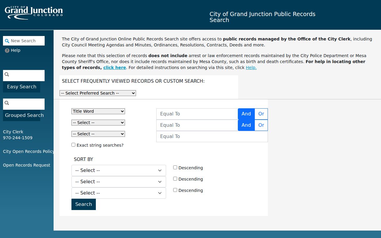
Search criteria, record class, retention, last action, disposition, and supporting documents can matter.
Use the polygon for map context, then ask the association or custodian for any public contact route. Do not infer membership from a mailing address, parcel, map color, or neighborhood name.
Lincoln Park and Emerson Park Records
2017 Grand Junction city minutes show Lincoln Park and Emerson Park applications and describe city assistance for non-binding neighborhood associations. The minutes describe Lincoln Park as approximately 110 residences with representatives. A 2009 city agenda also recognizes The Villas at Country Club and Grand Manor among organization-based properties. These records are useful local-history and civic-process clues.
The minutes do not establish a current member list, current boundary, meeting schedule, or current contact person. If a current association question matters, use the city's application route, the public GIS layer, the association's own public material, or a narrow City CORA request. Keep the record date and the distinction between an application, a recognized area, and a membership record.
| Local clue | What the reviewed source supports |
|---|---|
| Lincoln Park | 2017 minutes, application context, and about 110 residences described in the minutes. |
| Emerson Park | 2017 minutes and neighborhood-application context. |
| The Villas at Country Club | 2009 city agenda recognition; no current public directory located. |
| Grand Manor | 2009 city agenda recognition; no current public directory located. |
| Other association | City application route; no current official master list located. |
Block-Level Voter Visibility
Mesa Elections can supply selected report fields by district or precinct through its request form. Report codes include district and precinct information, joined voter history, registered lists, voter history for up to five elections, the last five elections, and walking lists. Filters include county, district, precinct, phone inclusion, party, and active or inactive status. Reports, maps, printed pages, certificates, and secure-email delivery have separate listed charges.
The observed form does not provide a simple open “all neighbors” export by block or ZIP. Ordinary lists omit confidential voters. The Colorado voter self-lookup also requires first name, last name, ZIP, and birthday for one person and may not locate a protected record. A public field can support civic or family research, but it should not be used to infer every person near a parcel.
Compare a precinct or district report with Mesa District Lookup, while keeping election year and report version. A precinct, legislative district, congressional district, commissioner district, and school district are different fields.
Civic Watch and Community Routes
Grand Junction's Community Resource Unit describes Neighborhood Watch, safe-community work, and security surveys. It is a civic contact route, not a public member roster. City forms, minutes, GIS metadata, City Clerk records, and public requests can show that a neighborhood process exists without exposing private participant details.
For block history, combine current parcel geometry with old city directories, Sanborn sheets, newspaper notices, and city survey PDFs. A historic directory can show an occupant or office at a date. A Sanborn sheet can show a mapped structure. A city record can show a permit or association application. Keep each source's date and relationship to the address.
A current neighborhood label is not proof that the same organization, boundary, or contact route remains unchanged. Ask the named custodian for the public field, and keep a note when the answer is “no current directory located.”
Official Rolls and Neighbor Tools
Official records and commercial neighbor tools have different strengths. The comparison is about evidence quality and access, not a recommendation of a service. An official record gives a custodian, field labels, date, and a way to request correction or a certified copy. A commercial tool may combine public and licensed data, charge for detail, or show an old match without making the source date clear.
| Route | Strength | Limit |
|---|---|---|
| County parcel or GIS | Address, parcel, district, map, and legal-record lead | Not a household-member list or occupancy proof |
| City records | Addressed permit, license, ordinance, or association process | Indexed scope varies; unindexed records need CORA |
| Voter route | Defined individual or report fields under election rules | Confidential voters and protected fields are omitted |
| Commercial neighbor tool | May offer a broad convenience search | Source, age, cost, accuracy, and lawful-use limits may be unclear |
For a reliable block clue, use the official source first, log the date, and confirm a second field. If the official source stops at a protected or unindexed record, stop there or make a narrow request.
Privacy Limits on Grand Junction Neighbors
A neighbor lookup cannot show every person connected to a block. Utility customer names, restricted DMV addresses, protected voters, confidential vital details, sealed court material, and private association rosters remain outside a normal map search. A parcel owner, mailing addressee, directory occupant, or voter is not automatically every person nearby.
The Colorado Address Confidentiality Program can supply a substitute address and mail-forwarding process for qualifying participants. Voter confidentiality can prevent a public match. CORA and CCJRA access still depends on custodian, exemptions, redactions, and lawful fees. A public record may be a research lead without being necessary or lawful to reproduce in full.
Use the block record lawfully. Grand Junction neighbors research may support local history, civic understanding, and a legitimate personal question. Do not use it to stalk, harass, intimidate, or harm a person, and do not try to defeat a protected-address or court restriction.
When the question shifts from the block to a named person, keep the parcel, date, and relationship fields and move to a person-specific custodian route. When it shifts to a whole street, use the address-centered record chain.